Friday, August 28, 2020

Hike: Robinson Lake / August 2020

Hike: Robinson Lake / August 2020

The road to Onion Valley at Kearsarge pass leads also to the road less traveled. And that would be a hike to Robinson Lake, a much-less visited trail that winds up to a, guess what, lake! :) Sub-alpine forests on the otherside of the Kearsarge Pass to a sub-alpine lake. As is almost always the case in the Eastern Sierras (or almost any part of the Sierra Nevada Mountains) the views range from the sublime to the epic.

 Sitting at an elevation of 10,500', Robinson Lake doesn't have the expected and common blue/turquoise sheen that most lakes high up in the peaks and valleys of the High Sierra has, but more of a deep emerald shimmer, which makes it fairly unique and striking. The reflection of 12,000+ peaks of the nearby mountains make this an enchanting place... calm, tranquil, less frequently traveled except by a group of women in their 20s who found it to be a great spot to sun-bathe nude. 

Length: 4 miles / Elevation gain: 1,300' / Highest Elevation Point: 10,500'.


Friday, August 21, 2020

Hike: Upper Kinney Lake / August 2020

Hike: Upper Kinney Lake / August 2020

Kinney Lakes (off Ebbetts Pass, road elevation 8,736') is a hidden gem in the Sierras. Ok, well, it's really not that hidden. Anyhow... You want lakes? You got lakes! You get a lake! And you get a lake... and you get a lake!
 
Not a huge amount of elevation gain on this hike (only about 700' or so) and it sits at a nice elevation of around 8,800', and the mileage isn't too bad either (roughly 4.5 miles roundtrip) but the views are really grand and, is always the case in the Sierras, at certain points, truly astounding.

At the upper lake, this is where this trail terminates - at least if this is your destination. Not a huge lake, but pristine. Tranquil, supple and from some angles, it looks like natures own Infinity Pool.

Length: 4.5 miles / Elevation gain: 689' / Highest Elevation Point: 8,910'.


Sunday, August 16, 2020

Road Trip: Through the Los Padres National Forest / August 2020

Road Trip: Through the Los Padres National Forest / August 2020

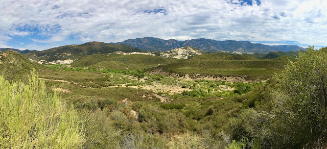
This road trip turned out to be a spontaneous, spur-of-the-moment excursion into and though part of teh Los Padres National Forest. We pull off I5 north of Gorman to check out Frazier Mountain. Couldn't find the trailhead, so decided to road trip the rest of the afternoon. Frazier Mountain road to Lockwood Valley Road into the LPNP until we hit Maricopa Highway (33) and headed south, up into the mountains and through. I'd never actually been to or through this area so it was all entirely new to me. Quite some scernry and scenic vista views as we climbed S/SW/W up 33 into the mountains. Dry, hot (100º-110º) and dusty. Definitely going to come back to this area and explore the hiking options sooner than later.


Thursday, August 13, 2020

Hike: Los Angeles: Los Liones Trail / August 2020


Hike: Los Angeles: Los Liones Trail / August 2020

This was more of an urban hike to a degree since it is in the heart of the Pacific Palisades, near Santa Monica in the environs of Los Angeles. Since it's so close to an urban center, as you can imagine, it was pretty crowded. In fact, this was the most crowded hike I've done so far. Literally scores (maybe hundreds) of people on this trail on any given point at any given time - concurrently. Crazy. Not everyone wearing their mask or following trail etiquette, either, which isn't surprising, but a bit frustrating. Nonetheless a fun but traditional hike. Great views of the Pacific Ocean and some of the cooler houses and homes in the canyons of the Palisades, too.

Length: 5 miles / Elevation gain: 1,115' / Highest Elevation Point: 1,500'.
 

Wednesday, August 5, 2020

Hike: Eastern Sierra: Mono Pass / June 2020

Hike: Eastern Sierra: Mono Pass / June 2020

First of all, one of the cool things about this hike is that it STARTS OFF WAY ABOVE where most hikes end - at 10,000', almost the height of Mt. Baldy. And then you proceed to maintain that alpine level and climb numerous switchbacks - literally up and along the side of a 12,800' peak (Mt. Star) near other 13,000' mountains, and into a valley - still covered in snow - past numerous mountain lakes - and ever more upwards to more mountain lakes.

I can tell you from experience on this hike - hiking at an elevation above 10,000' is no joke. On the way down, I've never (ever) experienced the exhaustion I did - first time, ever, in fact- where multiple breaks were required, constant hydration, and every step was laborious. Coming down was probably more intense than going up. Gatorade and food is a must, as is a strong heart and a stout mind... not to mention some working legs.

But the visuals and the heights and elevation were truly amazing. Majestic and magnificent are a great place to start. Some of THE best mountain views yet.

Length: 7.5 miles / Elevation gain: 2,115' / Highest Elevation Point: 12,189'.